

You heard something about mapping with UAV / Drone, but you don’t know how and where to start? Then you’ve come to the right place because in this article we have discussed the topic “Mapping with UAV at a Basic Level” for our colleagues.
1. Select your UAV
The first thing you need to do is choose the appropriate UAV for the job. The UAVs have a wide range of products available on the market but if you make a good choice, you can use them for both long-term entertainment and professional applications.
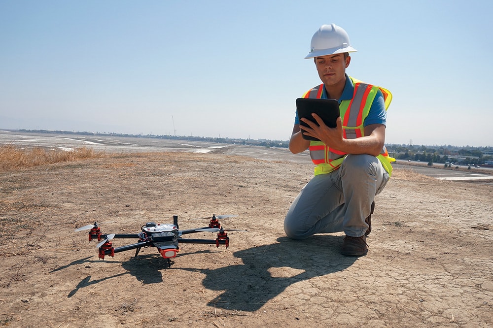
Note: Do not forget to register your UAV and obtain your UAV license after you have received your UAV.
2. Identify your UAV Mapping Ecosystem
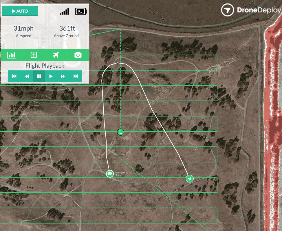
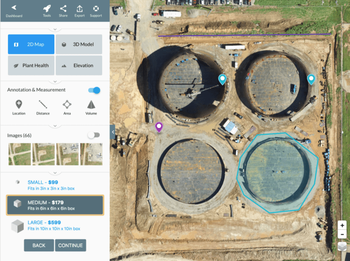
Once you have set up your device, all you have to do is choose a mapping solution that includes a smartphone application and a web platform. The application will help you plan your flight properly and take control of the UAV to complete the measurement automatically. After the flight, you will need to transfer the data from the UAV to a computer. To do this, you need to remove the micro SD card from your aircraft, connect it to a computer, and install a web-based tool that allows you to process and analyze the collected data.

If you take images of the same object from at least two perspectives in an UAV measurement, you get a stereoscopic 3D image. Therefore, UAV images should overlap considerably. Popular platforms for UAV mapping, Pics4D, Drone Deploy and Data Mapper give you both the application and web-based tools.
3. Plan Your Flight
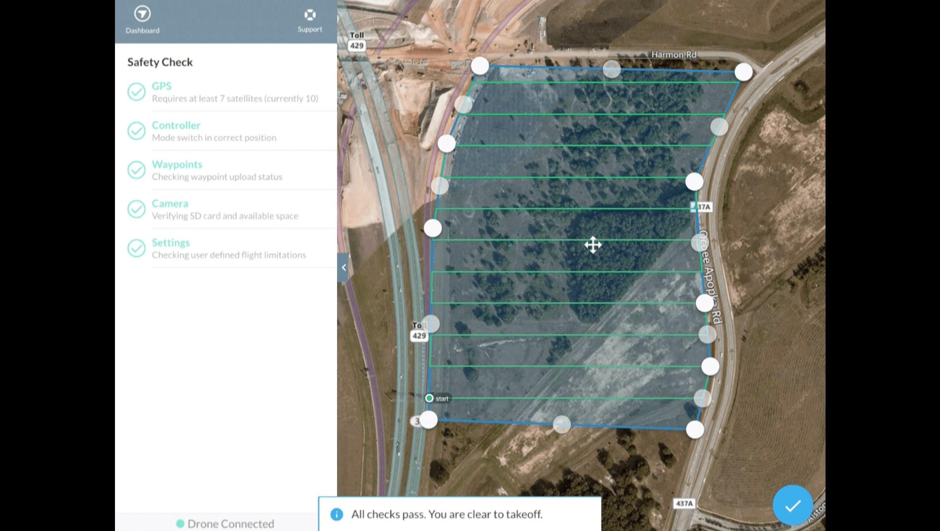
When flying a plane, your priority should be security. For your first mapping project, choose an area without trees and tall buildings and don’t fly over people. The area of the project should not be too large or too small. An area of 100x100m is good for starting up. You need to draw a flight plan to surround the area or structure you want to map.
You can do this using satellite imagery, but keep in mind that pictures may be outdated in some places.
Don’t be in a hurry when you’re planning, as a minor mistake can cause your UAV to crush and damage, so you need to make sure that the scope selected in practice is exactly compatible with the area you want to match in the real world.
One of the most important parameters is the height of your flight. The lower the altitude, the more the UAV