News
You can find the latest breaking news about Surveying, Mapping, Lidar, and Photogrammetry for the geospatial community.

Bentley Opens Up Full Access to ProjectWise 365 an…
By
When we have to stay in our homes due to Covid-19, our work systems are also heading for a radical…
3 min read
627 reads

How China is using technology to fight coronavirus
By
The Wuhan coronavirus outbreak has become a global calamity, leaving thousands dead, millions vulnerable, supply lines collapsed, economies derailed, factories…
4 min read
425 reads

A New Dubai in Heart of Balkans
By
In early 2019, I have been in Belgrade to study a long-discussed urban transformation project. The attention of investors around…
3 min read
920 reads

ESRI Turkey’s Free Online Course “Powe…
By
Whichever industry you are in, there is location information in your business. This location information contains many details that you…
< 1 min read
712 reads

Surveying Group at Bundles, Turkey’s most po…
By
The new version of Bundle, including Surveying Group, is on the App Store and Google Play! Bundle 2.5 offers a…
2 min read
920 reads

Mixed Reality Boosts BIM in Construction
By
Mixed reality solutions are new data platforms that reduce the time required to place models in the physical space. It…
2 min read
895 reads
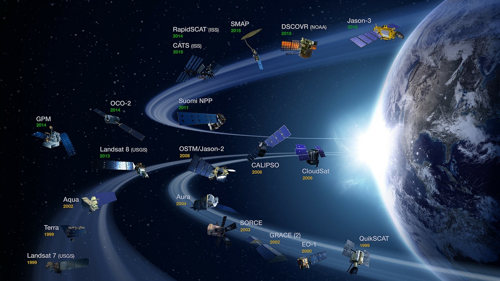
Latest Satellite List
By
Do you think you know remote sensing satellites? Think again. Here are the 50 most popular satellites that are quietly…
10 min read
1K reads
Carlson Introduces New iCAD 2019
By
Carlson, a CAD software manufacturer, launched its new product, iCAD 2019. new tool palettes, new 3D commands, DGN support and…
< 1 min read
729 reads

Yuneec-H520, Your new assistant in the field
By
It is possible to encounter an innovative product almost every day in the cartography sector. One of the newest of…
< 1 min read
750 reads

Autodesk Increases Construction Efficiency!
By
Autodesk acquired PlanGrid, a leading construction efficiency software, for $ 875 million. This acquisition will enable Autodesk to offer a…
< 1 min read
736 reads


