Satellite Imagery
Learn more about how to use the latest satellite imagery with insights, and tips.
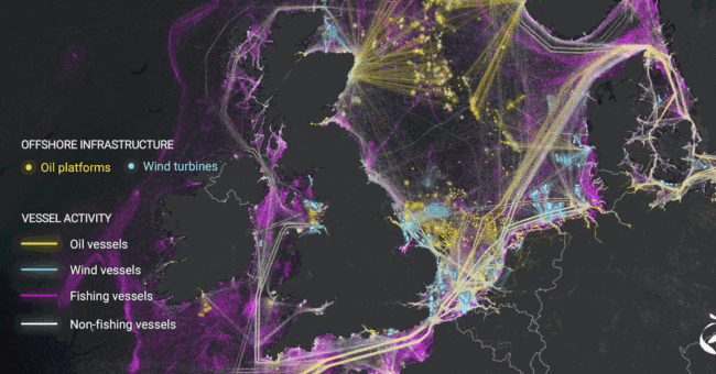
AI Helped to Analyzed 2000 Terabytes Satellite Ima…
By
Breakthroughs in AI and satellite imaging have empowered researchers to generate the most detailed depiction to date of human activities…
4 min read
1K reads

EUSI and Pixxel’s Pioneering Hyperspectral I…
By
Introduction to the Strategic Alliance European Space Imaging (EUSI) has recently announced a pivotal partnership with Pixxel, granting direct access…
2 min read
1K reads
Top 14 Free Satellite Imagery Data Source Provider…
By
This is a list of free satellite imagery providers. In fact, these sources helped many of professionals daily. So if…
3 min read
10K reads
How To Detect Deepfake Satellite Imagery?
By
In areas related to satellite imagery, deepfake imagery is becoming a problem for individuals and organizations alike. There is a…
2 min read
1K reads

NASA Measuring The Noise Footprint Of Electric Air…
By
Joby Aviation and NASA are kicking off a two-week test campaign to study the acoustic signature of Joby’s all-electric passenger…
2 min read
1K reads
What Is Deepfake Imagery?
By
In areas related to satellite imagery, deepfake imagery is becoming a problem for individuals and organizations alike. There is a…
< 1 min read
1K reads
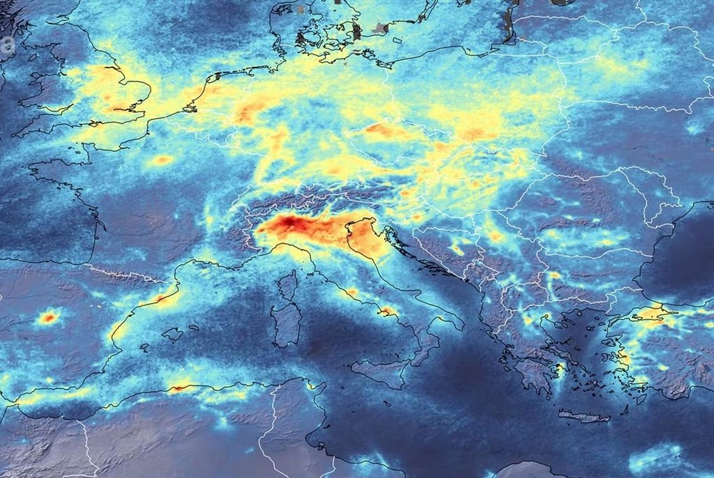
Satellite Images Shows, Air Pollution and CO2 Fall…
By
Levels of air pollutants and warming gases over some cities and regions are showing significant drops as coronavirus impacts work…
3 min read
1K reads

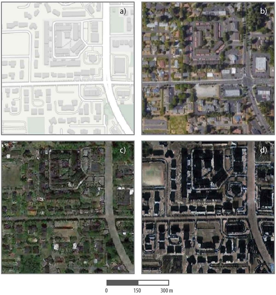
Higher Resolution, More Spectral Bands
By
The designer, manufacturer, and operator of the largest constellation of Earth imaging satellites, Planet, is preparing to offer its highest-resolution…
2 min read
822 reads


