LIDAR
You can find the latest Lidar news, the best guides, and how-tos for the geospatial community.
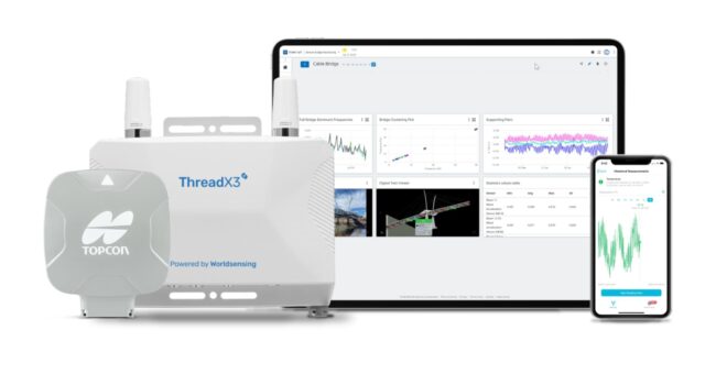
Topcon Technology Integrated into Bentley Systems…
By
Topcon Positioning Systems has announced strategic agreements with Bentley Systems and Worldsensing to integrate its advanced GNSS (Global Navigation Satellite System) technology into the companies’…
2 min read
121 reads
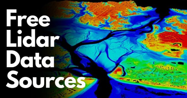
20 Best Free Lidar, DTM, DEM, and DSM Data Sources…
By
This is a comprehensive list of free LiDAR, DTM, DEM, and DSM data sources that will prove invaluable for various…
7 min read
482 reads
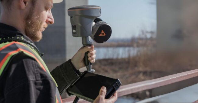
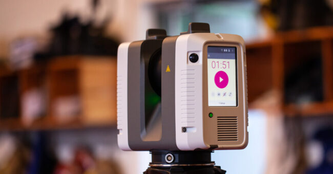
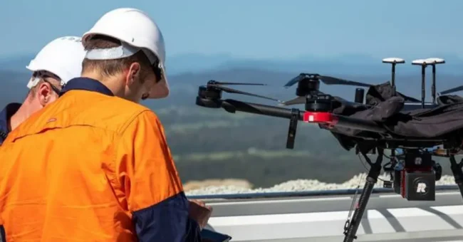
New CHC RS10 “Handheld SLAM LiDAR with RTK G…
By
CHC Navigation has introduced the RS10, a handheld SLAM LiDAR laser scanner integrated with a full RTK GNSS receiver. Geared…
2 min read
523 reads
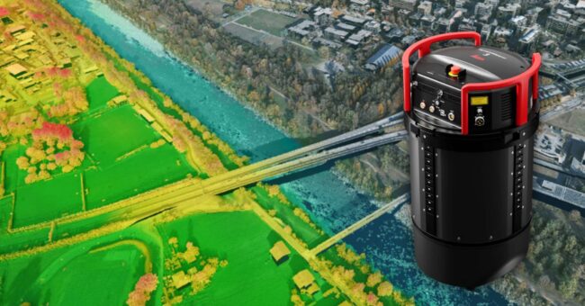
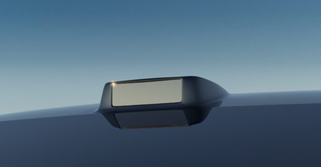
New Leica TerrainMapper-3 Airborne LiDAR Sensor
By
Leica Geosystems, part of Hexagon, introduces the Leica TerrainMapper-3 airborne LiDAR sensor, featuring new scan pattern configurability to support the…
2 min read
544 reads
Scan to Plan or Scan to BIM? Choose your side!
By
When executing a site survey, monitoring construction progress, or creating models, accuracy is the key to success — whether you’re…
4 min read
571 reads
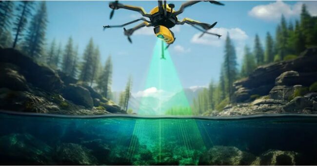
YellowScan Announced the New Bathymetric LiDAR Sol…
By
YellowScan, a prominent player and innovator in the field of LiDAR solutions for unmanned applications, has unveiled its latest bathymetric…
< 1 min read
656 reads
RoboSense Announces New M Platform LiDAR Sensors a…
By
RoboSense, a LiDAR and perception solutions company, unveiled its latest M Platform line of sensors today at CES 2024. Following…
2 min read
348 reads
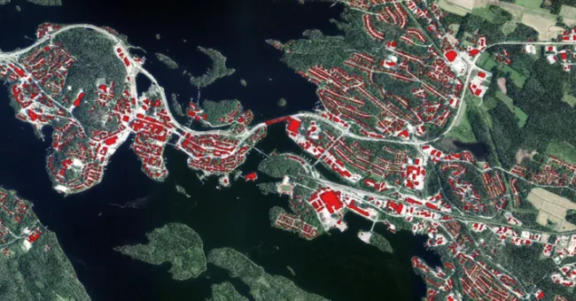
Artificial intelligence helps refine building data…
By
The National Land Survey of Finland (Maanmittauslaitos) has undertaken a pioneering initiative to utilize artificial intelligence (AI) in correcting inaccurate…
2 min read
302 reads
RIEGL’s Latest UAS LiDAR Solutions: Performa…
By
RIEGL manufactures high-performance LiDAR sensors and systems specifically designed for UAS (Unmanned Aerial Vehicles) integration and can strategically adapt the…
2 min read
650 reads
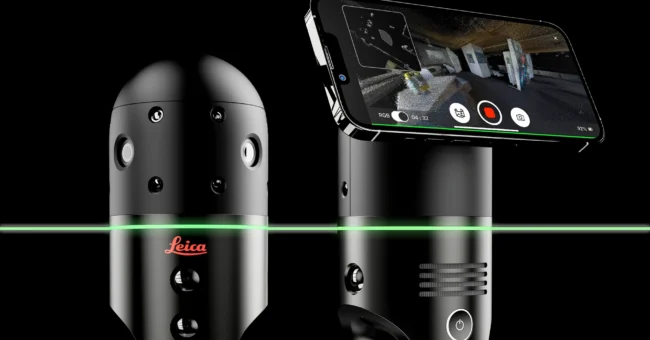
Leica Geosystems BLK2GO PULSE: The Future of Mobil…
By
The BLK2GO PULSE is a new first-person laser scanner that combines cutting-edge LiDAR sensor technology with the original Leica BLK2GO…
2 min read
1K reads


