Satellite Imagery
Learn more about how to use the latest satellite imagery with insights, and tips.
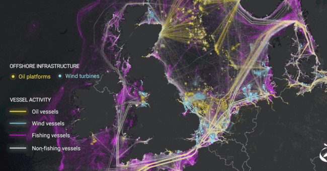
AI Helped to Analyzed 2000 Terabytes Satellite Ima…
By
Breakthroughs in AI and satellite imaging have empowered researchers to generate the most detailed depiction to date of human activities…
4 min read
1K reads

EUSI and Pixxel’s Pioneering Hyperspectral I…
By
Introduction to the Strategic Alliance European Space Imaging (EUSI) has recently announced a pivotal partnership with Pixxel, granting direct access…
2 min read
1K reads
Top 14 Free Satellite Imagery Data Source Provider…
By
This is a list of free satellite imagery providers. In fact, these sources helped many of professionals daily. So if…
3 min read
11K reads
Free Access to 10m Global Satellite Map from MapTi…
By
Cloud-free satellite images are used in real estate websites, mobile apps, globes, games, and virtual worlds, in the infotainment systems…
< 1 min read
521 reads
How to Detect Deepfake Satellite Imagery?
By
In areas related to satellite imagery, deepfake imagery is becoming a problem for individuals and organizations alike. There is a…
2 min read
2K reads
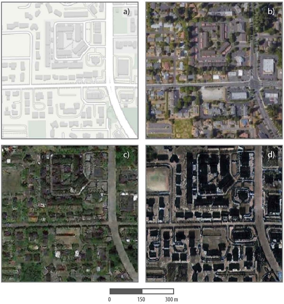
What Is Deepfake Imagery?
By
In areas related to satellite imagery, deepfake imagery is becoming a problem for individuals and organizations alike. There is a…
< 1 min read
2K reads
Sentinel-2 Collection Is Available For Digital Twi…
By
Horizon 2020 Global Earth Monitor project and the European Space Agency’s Digital Twin activities scientists Matic Lubej and Grega Milcinski create…
2 min read
478 reads
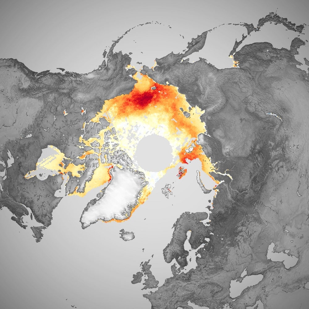
Arctic Sea Ice Level Observation From 40 Years of…
By
Throughout 2020, the Arctic Ocean and surrounding seas endured several notable weather/ climate events. In spring, a persistent heatwave over…
2 min read
449 reads

Higher Resolution, More Spectral Bands
By
The designer, manufacturer, and operator of the largest constellation of Earth imaging satellites, Planet, is preparing to offer its highest-resolution…
2 min read
998 reads


