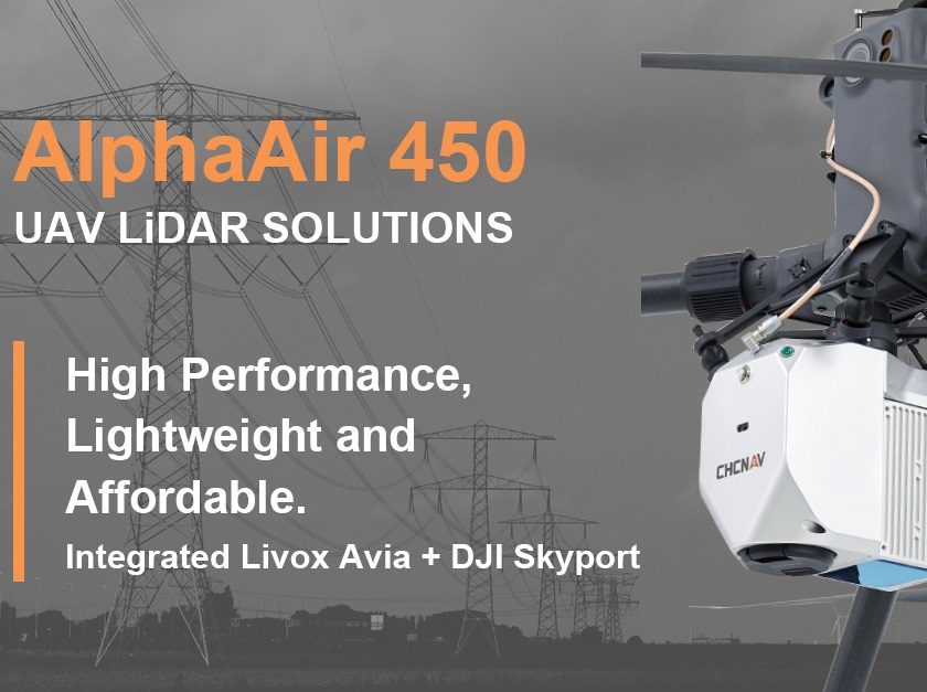
The lightest, advanced accurate, and cost-effective UAV LiDAR system in its class.
CHC Navigation (CHCNAV) announced the release of the AlphaAir 450 (AA450) LiDAR system. The AlphaAir 450 is a very lightweight and compact all-in-one sensor. Featuring internal IMU, GNSS, 3D scanner, and camera, the AlphaAir 450 solution is widely used for power line inspection, topographic mapping, emergency response, agricultural and forestry surveys, and more. The unit is easy to use, and it is allowed for rapid deployment in the field.
“Despite the fact that the LiDAR scanning is an efficient technology to capture 3D data, it still often remains costly and complex to operate,” said Andrei Gorb, Product Manager of CHC Navigation’s Mobile Mapping Division. ” Taking that into account, we introduce the AlphaAir 450 (AA450), a breakthrough LiDAR scanner, that delivers user-friendly and high-accuracy capabilities at a reasonable price.”
There are three key aspects of the AlphaAir 450 that quickly created a buzz in the drone users’ community as a new solution for capturing geospatial data:
Lightest unit in its class – With this new compact and lightweight solution that can be easily mounted on UAVs, data capture has become faster and more efficient. The LiDAR’s weight is a constraint for any drone. The AlphaAir 450 weighs 1 kg, which is perfectly suited to the drones’ payload requirements. The lighter the unit, the longer the operating time of the drone, and the greater the productivity.
Advanced accuracy – By combining industrial-grade GNSS with a high precision IMU, the AlphaAir 450 can easily achieve absolute accuracy of 5 cm (vertical) and 10 cm (horizontal) for small survey areas, which is typically adequate for most use cases. To further improve precision and accuracy, users can apply adjustment algorithms in the CHCNAV CoPre software.
Industrial reliability – Featuring IP64 high-level protection, the AlphaAir 450 extends its operating temperature capabilities, down to -20℃ and up to +50℃, in any field environment and increases users’ return on investment by providing more field survey days in a year.
Discover more about AA450.
CHC Navigation (CHCNAV) creates innovative GNSS navigation and positioning solutions to make customers’ work more efficient. CHCNAV products and solutions cover multiple industries such as geospatial, construction, agriculture, and marine. With a presence across the globe, distributors in more than 100 countries, and more than 1,300 employees, today CHC Navigation is recognized as one of the fast-growing companies in geomatics technologies. For more information about CHC Navigation, please visit www.chcnav.com.
Source: CHCNAV