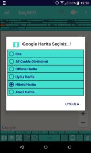
5. You can use different Google Map pads as well as location-based 3D Virtual Reality.
6. SelectGo With Compass, you can track how many degrees and gradations you have progressed from the north when navigating on the map.
7. You can measure distance and area in different coordinate system via Google Map Coasters.
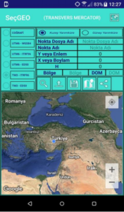
8. You can do Point Application in different coordinate systems from all over the world.
9. While mobile, you can obtain detail point acquisition on earth in different coordinate systems and save with location-based altitude information, then you can make quick multi-share.
10. You can generate data via Google Map Base with different Coordinate Systems.
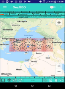
11. National Coasters Google Maps Turkey on 1: 25,000 scale can turn the Index Sheet.
12. You can enrich your Survey studies with the maps loaded with thematic information that you get through the WMS server while you are browsing the Google Map Coasters that you use in our SeçGEO Mobile Map Application, instantly, in the project area.
13. You can upload your projects to SeçGEO Mobile Application with KML, Google Earth data format.
14. With SeçGEO Mobile application, TUSAGA-ACTIVE can quickly upload station locations to Google Map Coasters, Map Display
and share multiple.
15. With the signals it receives from the satellite, you can see the required SPEED values in miles / knots and km units while mobile at sea / air / land.
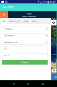
16. You can access the feature of querying the parcel information produced within the General Directorate of Land Registry and Cadastre with SeçGEO Mobile Application.
17. You can access ATLAS application produced by Map General Directorate with SeçGEO Mobile Application.
18. With the application’s Multi-Language Option you can have the ability to convert to different languages, including English, German and Turkish, anywhere in the world.