There is no doubt, surveying technologies have become valuable tools for analyzing the state of conservation of historic buildings. One of the latest technologies are Lidar SLAM systems, which allow data collection simply by walking. While powerful, a SLAM system is not sufficient to obtain a complete digital model
In this case study, you will learn the main data collection steps of the process.
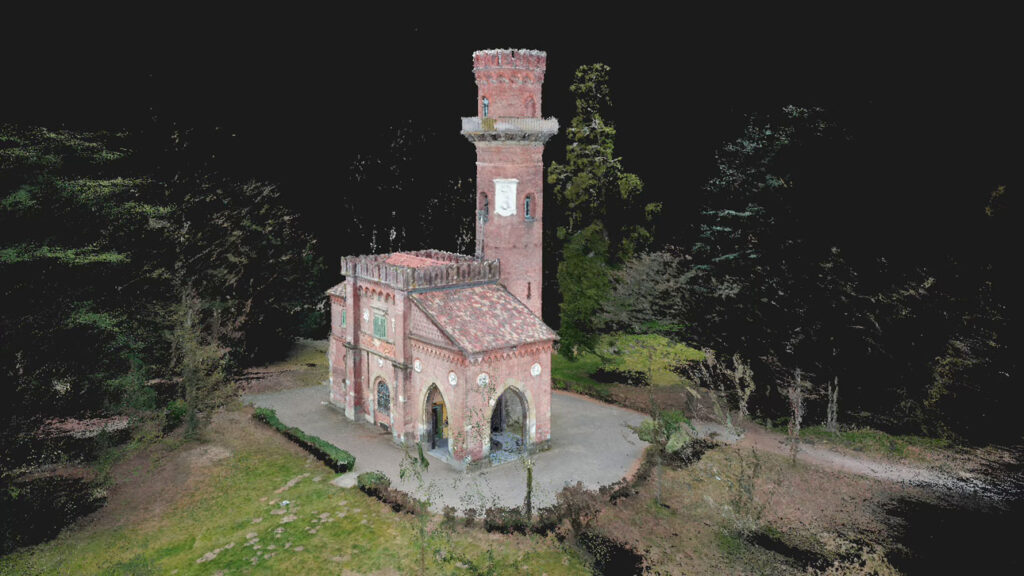
Obtain a detailed and geo-referenced 3D model of the building in order to produce accurate elevations and floor plans of interiors and exteriors. Before diving into the Surveying Methods, let’s have a look at the amazing building.
The building with neo-Gothic forms was designed by Canonica in the early 1800s, but the project was only carried out in 1822, when Giacomo Tazzini decided to exploit the rural building of the old Tuscan farmhouse to create a “Gothic” building with a tower.
The building develops on two floors with a side portico and a tower with a lookout at its top. An engraving by Frederic Lose dated 1826 and entitled “La Tour dans le jarden”, shows the tower finally completed and identical to how it is today. Therefore it can be deduced that the completion date of the works is between the end of 1824 and the beginning of 1826.
Let’s jump to the details of the project!
Different surveying instruments and software were used to obtain a complete and detailed interior and exterior project.
The GNSS receiver was used to measure the Ground Contol Points to be associated with the aerial photogrammetric data. A topographic survey was carried out with a GNSS receiver and a total station in order to georeference all the collected data with maximum precision.
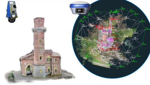
All these data were processed in the office using Stonex software such as Cube-manager, Cube-3d, and Reconstructor software.
The bigger laser scanner, given its range of 300m and the ability to create very dense and extremely precise point clouds, was used for outdoor data collection, in particular, to capture the details and decorations of the tower facades.
Another laser scanner, with a minimum range of 20cm and a maximum of 150m, is a light and versatile instrument and has been used to collect data both indoors and outdoors. The clouds produced by this were then colored thanks to an integrated 360 HDR camera.
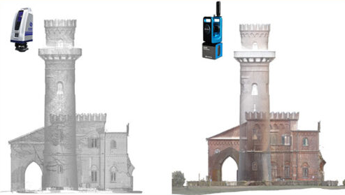
The entire range of Laser Scanners (X300, X150, and XH120) has been used to obtain high-quality orthomosaics and a reliable survey from a metric point of view starting from the digital twin of the building.
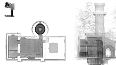
Finally, the portable laser, with its SLAM (Simultaneous Localization And Mapping) technology, proved to be invaluable in being able to return a precision plan of the walls and to collect data inside the narrow tower. The data from the SLAM-based survey also allowed a perfect point cloud registration of indoor and outdoor.
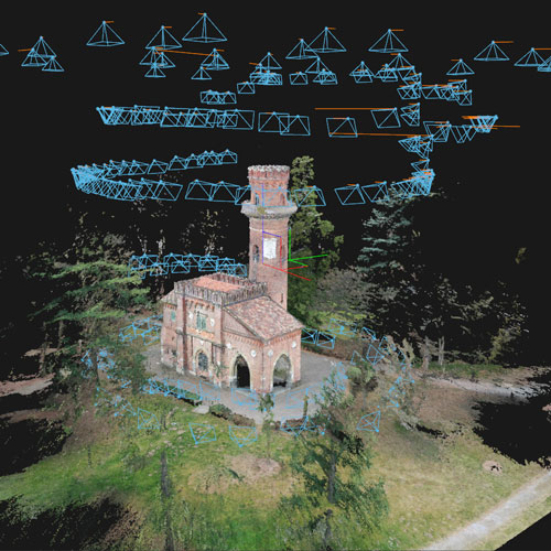
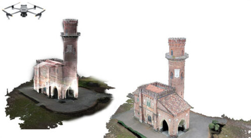
A photogrammetric survey carried out with a drone made it possible to collect 230 photos and to integrate the data on the ground with the aerial one.
Reconstructor was used for the filtering and registration of point clouds from Laser Scanner while with Cube-3d it was possible to create the final project of merging all the collected data as it is able to read a wide range of formats.
Now you can manage the complete photogrammetric project (photo, 3d model, orthophoto), import point cloud files from laser scanners (since it can handle clouds generated by any source) Import and manage the CAD data of the topographic survey (points, polylines, etc.)
The final result confirms that the integration between laser scanner data (TLS and SLAM) and photogrammetric survey (aerial) allows to obtaining a geometrically reliable digital 3D model enriched with color data.
These surveys were carried out with the partnership of the Consorzio Parco Villa Reale as part of a redevelopment project for the Tower itself.
Here you can find the all equipment and software that have been used this project as a list below,