One of the interesting products of INTERGEO 17 is that it has already made us curious. The new RIEGL Bathycopter! As the name implies, it is a helicopter performing bathymetry. RIEGL’s BathyCopter, hydrographic applications; production of coastline and inland waterway profiles. Susan Licari, sales and marketing director of Riegl, has answered those who are curious about these new products.

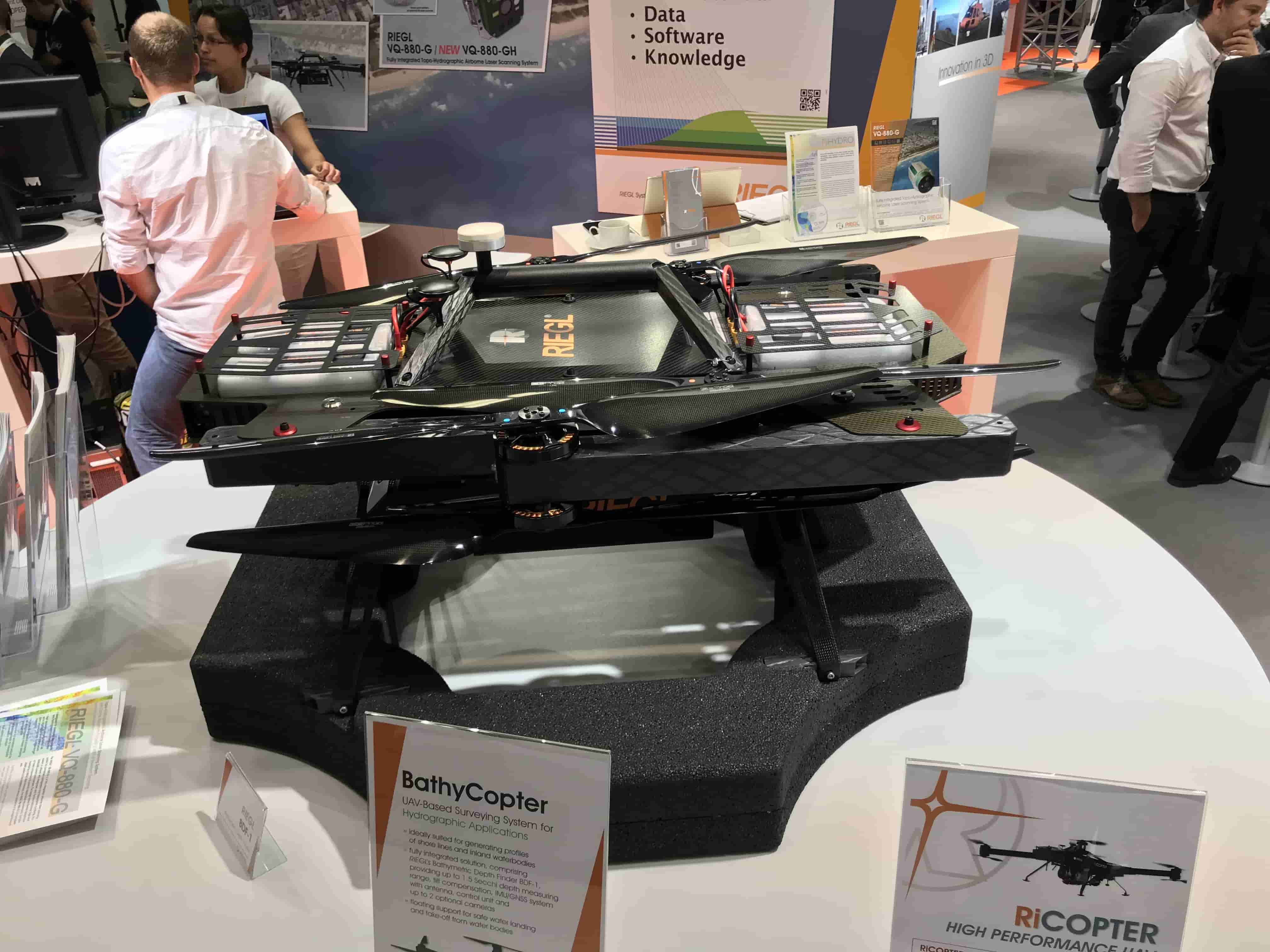
Question: How is a helicopter able to take bathymetric measurements? Susan: Probably one of the most frequently asked questions. The answer is simple “Lidar sensor”. To summarize, RIEGL’s remote pilot RiCOPTER’s robust and reliable platform design includes the new RIEGL BDF with a small and light bathymetric depth finder with tilt compensator, an IMU / GNSS unit with antenna, a controller and up to two external digital cameras. It integrates -1. BDF-1 is a laser range finder specially designed for bathymetric measuring tasks. The BDF-1 can optionally be equipped with a miniVUX-1UAV LiDAR sensor. This sensor is a compact single-source laser scanner and provides real-time line scan data with 240GB SSD storage.
Question: What about waves? How do you avoid false signals in waves?
Susan: The device sends laser signals at 4 kHz. The echo signal of each laser signal is digitized and recorded for the entire range gate of 50m. This is the selectable range from which the returning signals can be measured. This range is used to separate echoes from different regions of scattered targets. It is then processed by a full waveform processing algorithm for analyzing waveforms. Thus, both false signals are eliminated and the most probable wave model is determined. Finally, data sets with high accuracy, high resolution and hydrography are provided to support point classification.

These datasets can be easily used in applications such as forming profiles in inland waters (rivers, lakes, canals), re-exploration of water reservoirs, measurement of canals, landscaping, planning and measurements for hydraulic engineering works.
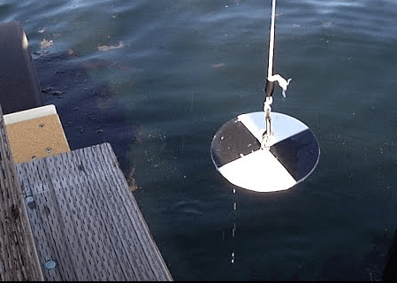
Only 1.5 secchi depth; It is possible to measure up to the depth of water that is detected as a measure of turbidity in the water, where the pattern on the bench disc cannot be discerned. In the days ahead we need to see it as the beginning of devices that collect data easily in deeper and turbid waters.
For more information click here